 What Registered Candidates say about EPR?
 Muhammad Qadir
Abbottabad, Khyber Pakhtunkhwa April, 2024
MashaAllah epr is best platform👍
|
 Usman Naseer
Rawalpindi, Punjab April, 2024
👍👍👍
|
 Rameez Raja
Muzaffarabad, AJK April, 2024
Thumbs up
|
 Muhammad Rizwan
Muzaffargarh, Punjab April, 2024
It is a great upportunity for students to register on epr and on 1 click you can apply on your job
|
 Haider Ali
Rawalpindi, Punjab April, 2024
Fantastic👍👍👍
|
 Nadeem Akbar
Sahiwal, Punjab April, 2024
Excellent EPR
|
 Mujahid Majeed Khan
Sahiwal, Punjab April, 2024
Good
|
 Ismail Khan
Peshawar, Khyber Pakhtunkhwa April, 2024
ismail khan
|
 Mujahid Amin
Okara, Punjab April, 2024
Good
|
 Qamar Aftab Khan
Murree, Punjab April, 2024
Epr is providing the best facility. Highly appriciated.
|
Select one for Next Step


Note: Online registered candidates will provide all necessary required documents at the time to apply his/her first Government Vancancy through EPR


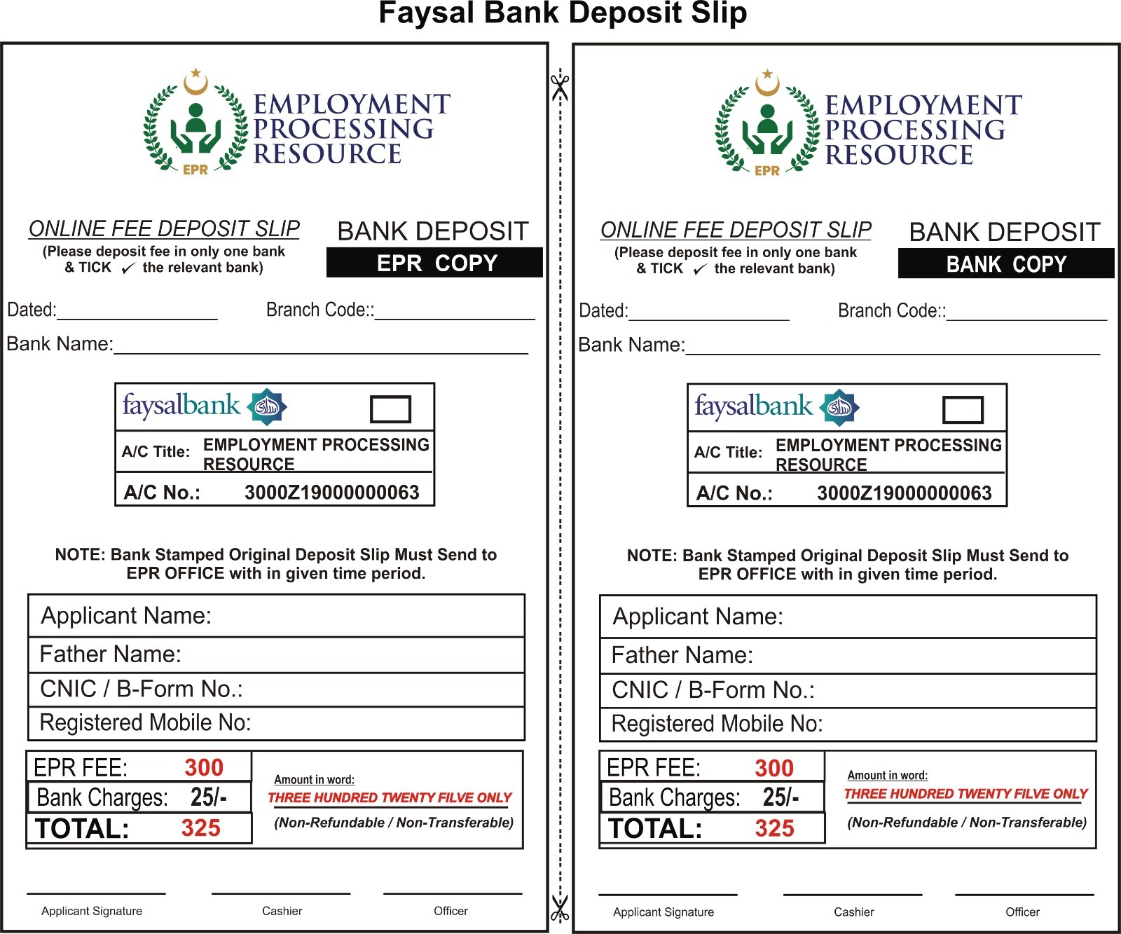
Test / Screening Fee:
0.00Courier Charges:
0.00Basic Processing Charges:
200.00Total Charges:
200.00Test / Screening Fee:
0.00Courier Charges:
0.00Advance Processing Charges:
0.00Total Charges:
0.00Khyber Pakhtunkhwa
Sindh
AJK
Punjab
Gilgit Baltistan
Balochistan
Islamabad
FATA
Qualification and experience:
OR
Instruction
Please must review and read attached advertisement before processing.


Copyrights © 2024 - EPR
All rights reserved.